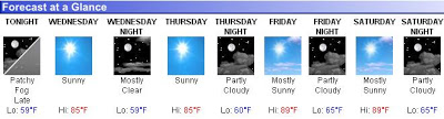
Truly, one of the wordiest forecasts I’ve seen on NOAA’s website. Here’s the weather for the rest of today and tomorrow…
Rest Of Today…Becoming windy and turning much colder. A period of rain…snow…sleet…or freezing rain early this afternoon…then snow. Snow may be heavy at times. A chance of thunderstorms. Widespread blowing snow this afternoon. New snow and sleet accumulation 2 to 3 inches. Temperatures falling to around 10 by late in the afternoon. Northwest winds 5 to 10 mph increasing to 15 to 25 mph with gusts to around 45 mph in the afternoon. Chance of precipitation near 100 percent.
Tonight…Bitterly cold. Much colder. Windy. Mostly cloudy with light snow likely in the evening…then partly cloudy after midnight. Blowing snow through the night. Snow accumulation around 1 inch. Total snow accumulation 3 to 4 inches. Lows around 8 below. West winds 15 to 30 mph with gusts to around 45 mph. Chance of snow 70 percent. Lowest wind chill readings 18 below to 28 below zero after midnight.
Wednesday…Bitterly cold. Much colder. Partly sunny. Areas of blowing snow in the morning. Highs around 10. West winds 5 to 20 mph with gusts to around 35 mph decreasing to 5 to 10 mph late in the afternoon. Lowest wind chill readings 18 below to 28 below zero in the morning.
In summary… 40 degrees this morning and, with wind chill, it’ll be 30 below tomorrow morning. Gotta love the 70 degree temperature swing in 1 day.